A planned place for ocean discovery · Lehigh Valley
Explore the ocean, starting from Bethlehem.
A planned place to understand, appreciate and explore Earth's oceans. The seafloor, marine life, the robots that reach them and, one day, ocean worlds beyond Earth. This site is for families, students, schools and neighbors: it shares the plan so you can follow it, learn from it and see how to take part.
Planning phase. An independent plan; nothing is funded or built yet. Planned for South Bethlehem; no building has been chosen yet.
Illustration · Planning phase · Not to scale. It shows exploration at sea; the center itself would run no boats.
The plan at a glance
What is planned, in short.
What it is. A planned center for free or low-cost public ocean education in Bethlehem, Pennsylvania: the seafloor, marine life and underwater robots that explore them. People have directly seen less than 0.001 percent of the deep seafloor (NOAA Ocean Exploration; Bell et al. 2025). It would reuse a building, use solar energy, and recycle and compost. Money is a tool, never the goal or a barrier.
Who it helps. Schools, families, future engineers and scientists, curious adults, and anyone needing a calm space or step-free access.
Where. Planned location: South Bethlehem (the SteelStacks campus and the East 3rd Street corridor). No building chosen; no owner or venue contacted. Planned seaport links, for field trips: Philadelphia, Newark/Elizabeth.
Status. Planning phase. An independent plan; nothing is funded or built yet. No organization, nothing for sale, no opening date. Partner: Aethon, the ocean data, mapping and exploration company founded by the plan's author. Aethon supplies the maps and data; the center does public education. Aethon does not fund, own, operate or approve the center. As of 20 October 2026, no other organization or port operator has agreed or been contacted.
Next steps. Free public programs with organizations that agree. Then, if each works, a temporary exhibit in a host venue, and a small center after a feasibility study. An aquarium is a separate decision; default no.
What it needs. A venue for programs, a fiscal sponsor or nonprofit, and advisors in science, education and accessibility. This summary asks for no money.
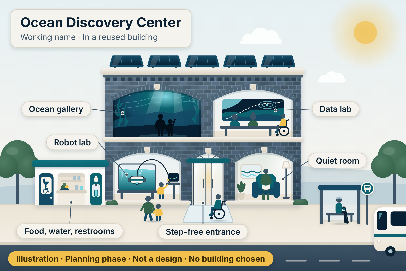 (opens the full-size picture, PNG)
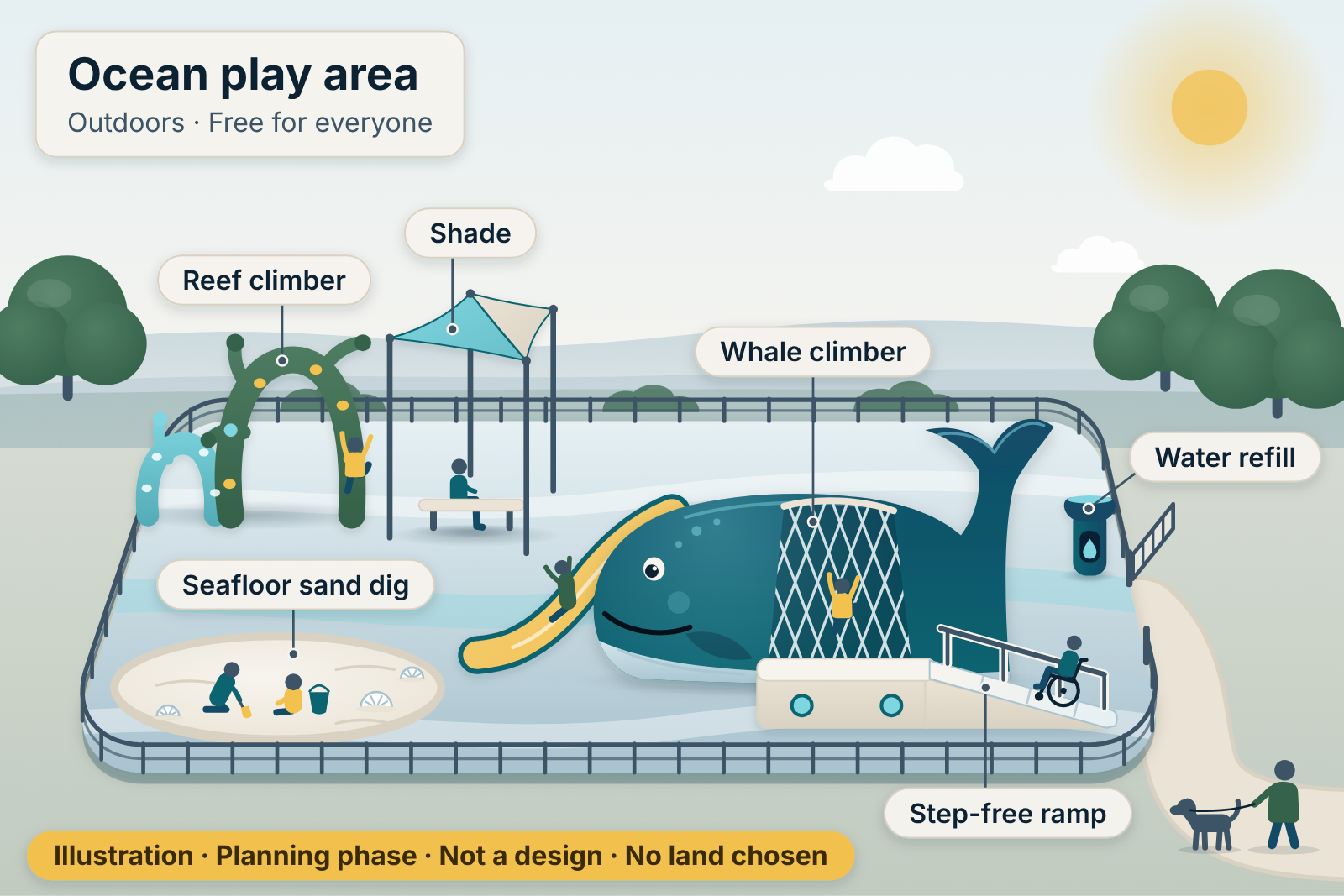 (opens the full-size picture, PNG)
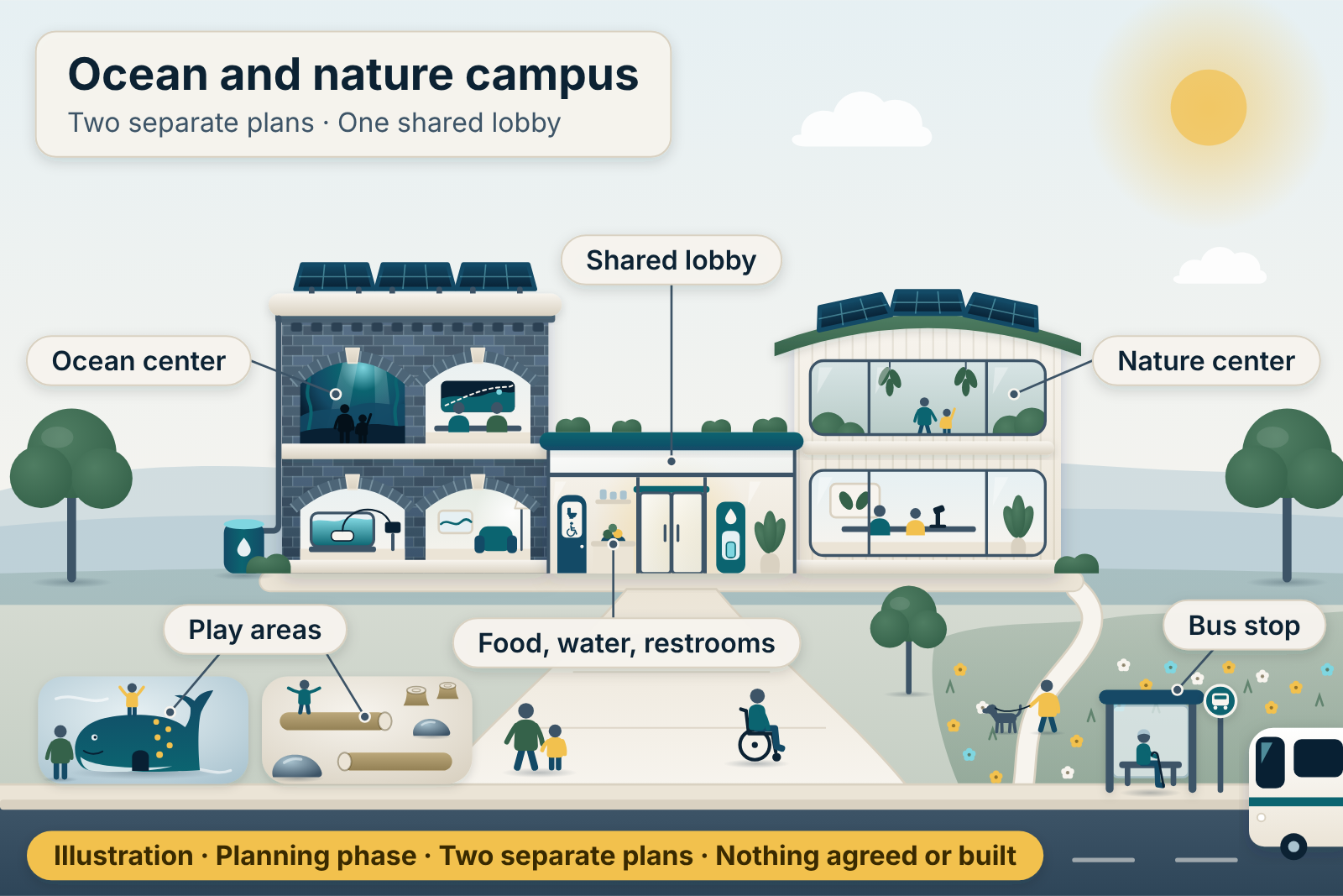 (opens the full-size picture, PNG)
Illustrations of a plan, not designs. Select a picture to open it full size.
Why it matters
Most of the deep seafloor has never been seen.
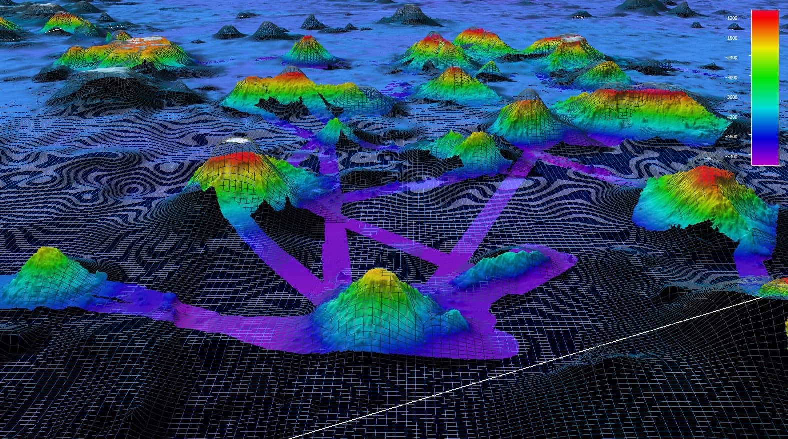
Satellites give a rough picture of the whole seafloor. Ships have mapped a growing share in detail. But the places people have actually looked at with cameras add up to a tiny fraction.
28.7%
As of April 2026, 28.7 percent of the global seafloor had been mapped in high resolution with modern sonar.Source: Seabed 2030 (Global seabed mapping reaches new milestone as five million square kilometres added in a year, 20 April 2026), Global seabed mapping reaches new milestone as five million square kilometres added in a year (20 April 2026)Source: NOAA (How much of the ocean has been explored?, April 2026), How much of the ocean has been explored? (April 2026)
As of 20 April 2026
< 0.001%
People have directly seen, with cameras, robots or crewed submersibles, less than 0.001 percent of the deep seafloor, an area roughly the size of Rhode Island.Source: NOAA (How much of the ocean has been explored?, April 2026), How much of the ocean has been explored? (April 2026)Source: Bell et al. 2025 (How little we've seen: A visual coverage estimate of the deep seafloor, 7 May 2025), How little we've seen: A visual coverage estimate of the deep seafloor (7 May 2025)
As of 2025–2026
How it could happen
Small steps, each one useful on its own.
Each step can stop without wasting the last. Nothing is built, sold or promised before it is ready.
Phase 0
Programs first
Talks, pop-up robot demonstrations and citizen-science days with existing local organizations, if they agree. No building needed.
Possible once a host or organization agrees
Format A
A temporary exhibit
1,000–3,000 sq ft in an existing venue, if one agrees to host. The way to learn who comes and what they want.
Recommended first exhibit, after Phase 0 programs
Format B
A small discovery center
An existing building of roughly 8,000–20,000 sq ft, if an owner agrees, and only if demand, governance and funding exist.
Only after a feasibility study
Format C
A future aquarium?
Considered separately and only if strict welfare, staffing, permit and money conditions are all met.
Default answer: no
Try it
Dive from the surface to the trenches.
A preview of the kind of interactive exhibit the center could offer. Move the slider to see how light and pressure change with depth.
200 m(656 ft)
- Zone
- Twilight zone
- Faint blue light, too dim for photosynthesis.
- Pressure (approximate)
- About 21 atmospheres
- Roughly one more atmosphere for every 10 meters of seawater, on top of the one atmosphere of air at the surface.
- Average ocean depth: about 3,682 m
- Challenger Deep, the deepest known point: ≈ 11,000 m
Zone boundaries follow NOAA and are conventions, not sharp lines.Source: NOAA 1 (Layers of the Ocean, undated), Layers of the Ocean (undated)Source: NOAA 2 (How deep is the ocean?, undated), How deep is the ocean? (undated)Source: NOAA 3 (How does pressure change with ocean depth?, undated), How does pressure change with ocean depth? (undated)
Why here
The ocean starts at our doorstep.
Rain on Bethlehem runs to the Lehigh River, which joins the Delaware at Easton and reaches the Atlantic through Delaware Bay. About 14.2 million people rely on water from the Delaware River Basin.Source: DRBC (Delaware River Basin population update, 8 February 2023), Delaware River Basin population update (8 February 2023)
What this website is, honestly
- Verified Facts from primary sources, each linked. The Research page lists each source's date (or says it is undated).
- Reported Facts from credible news or secondary sources.
- Proposed Our proposals and estimates. Nobody else has agreed to them yet.
- Unknown Questions only owners or agencies can answer.
Every drawing is an illustration of an idea, not a design. See all sources.
Data and mapping partner
One partner, for maps and data.
Partner: Aethon, the ocean data, mapping and exploration company founded by the plan's author. Aethon supplies the maps and data; the center does public education.
Aethon does not fund, own, operate or approve the center, and the center is not an Aethon facility. It is in the planning phase, with nothing built yet.
About Aethon
Aethon is an ocean data, mapping and exploration company. It became the center's data and mapping partner on 19 October 2026.
The same person founded Aethon and is planning this center. That is a conflict of interest. A future board would manage it with a conflict-of-interest policy, an independent board majority and arm's-length written agreements.
Aethon's own material appears here only as links, with credit. Nothing of Aethon's is copied, embedded or screenshotted.
Map viewer by Aethon Intelligence. Courtesy of Aethon, on Aethon's own site.